
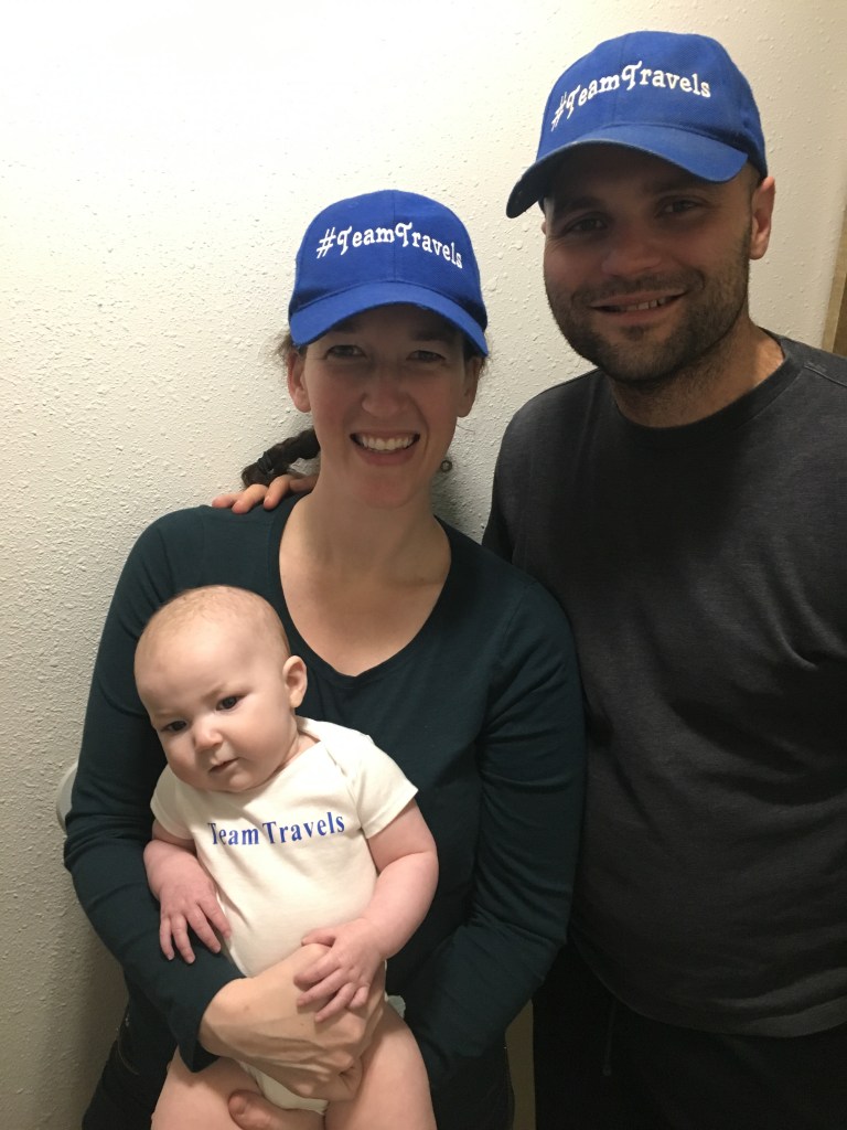
We couldn’t do it again if we tried! We drove exactly 2,019 miles on our first trip of 2019. We visited 5 National Monuments, 3 National Parks, a National Wildlife Refuge, a State Capitol and lots of other points of interest in between. Did I mention we did this with our 4 month old baby? #TeamTravelsBaby ! Check out our 5 day trip report (February 15-20).
Lucky for us, Spirit Airlines often flies for ~$100 round-trip to Denver from Baltimore. Even better is Denver is situated in the perfect place to take all kinds of amazing National Park trips. Check out our long October weekend to the Badlands and Wind Cave National Parks or our 7 day National Park trip that ended with Rocky Mountain National Park (an easy 90 minutes from Denver).
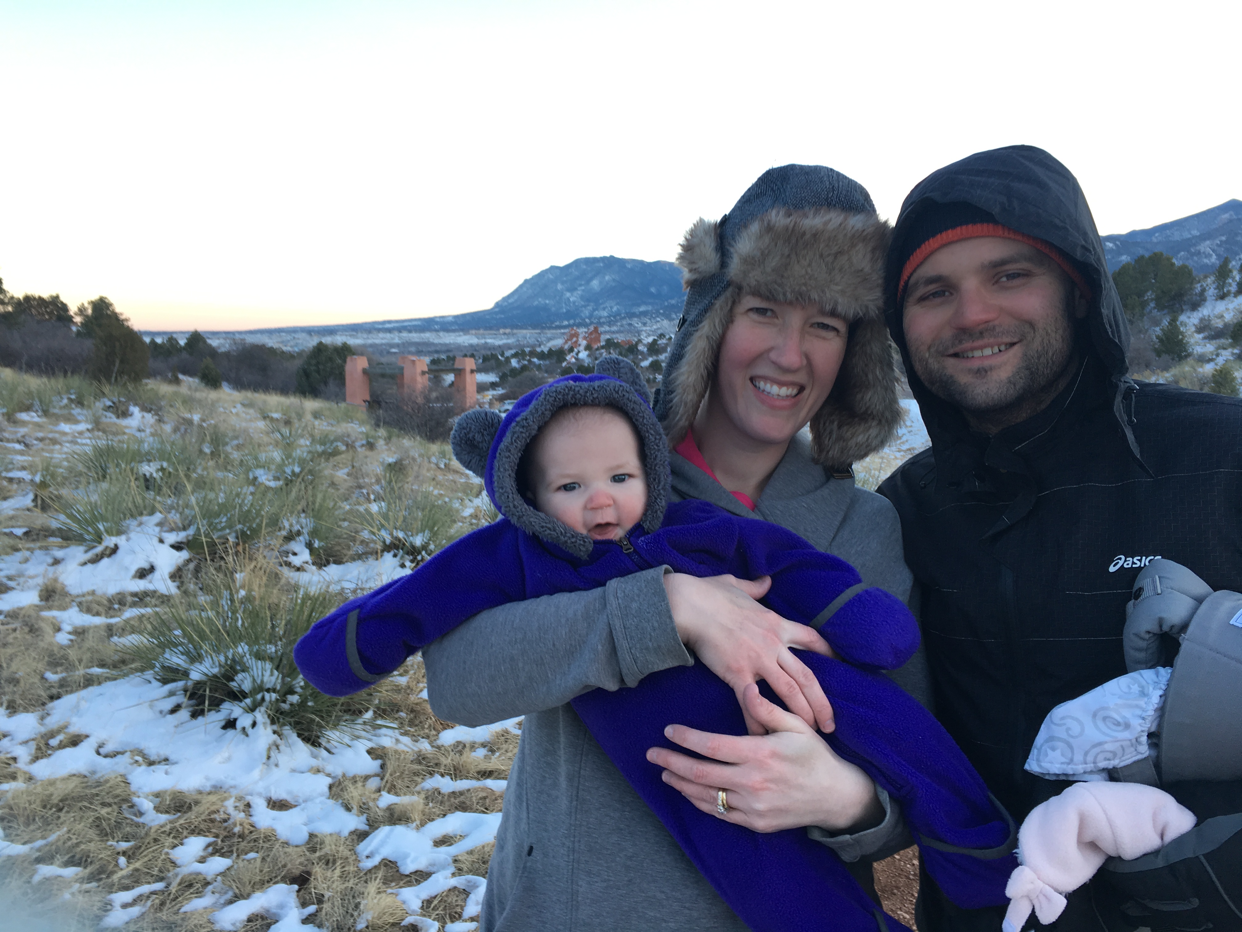
We are National Park junkies and have made it a goal to try and explore them all and we’re almost halfway there (Mike and I have visited 27 together)! My sister-in-law shares our love of hiking and adventuring and joined us on this ambitious trip out west (luckily Spirit offers a similarly priced trip from Detroit)! February is a COLD month to visit Colorado and New Mexico (think negative 12 degrees at one point) and we literally would not have been able to cover as much ground or have the five day trip we did without her help.

Day 1 (approximate miles driven: 550 miles)
- Start Day – Colorado Springs (Day 0, arrived late in the evening to DIA and drove here to sleep)
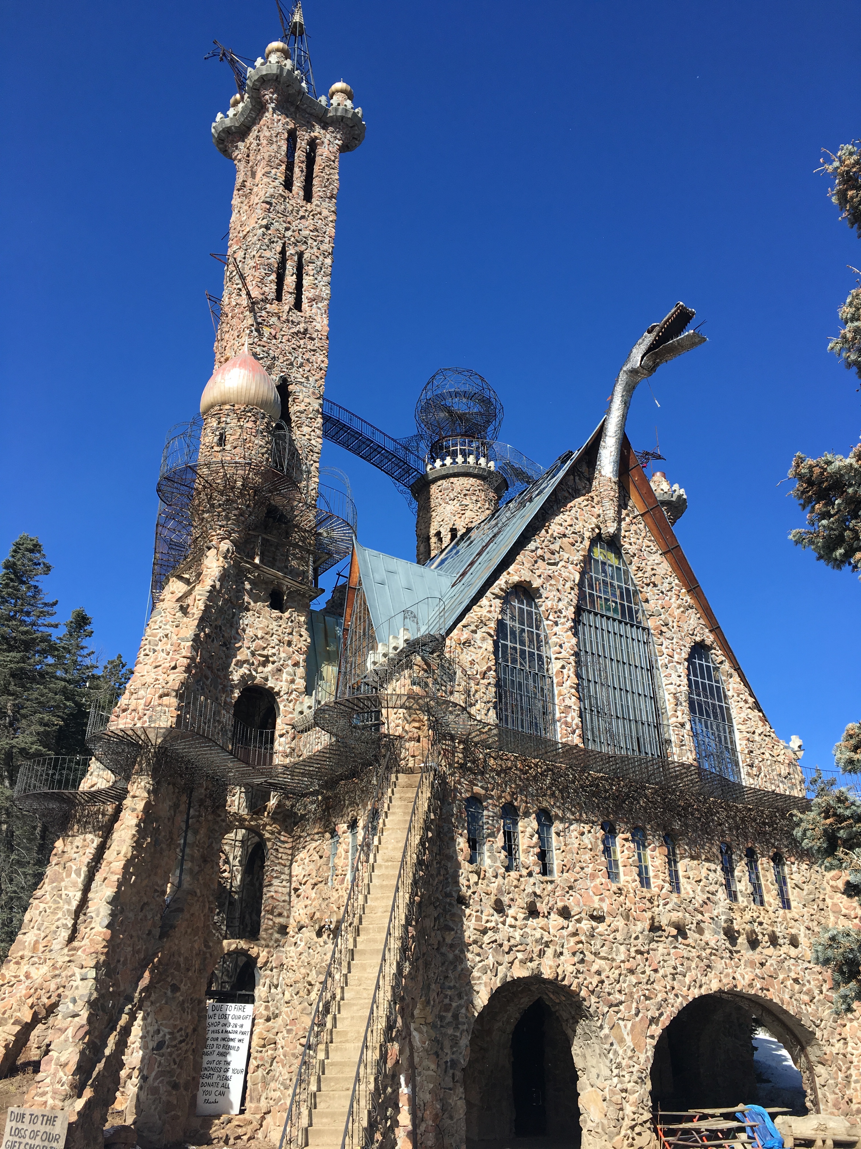
- Bishop Castle – Think crooked, unfinished castle with cool turrets, beautiful stain glass and a unique “found on the side of the road” Colorado vibe. Fun to explore at your own risk!
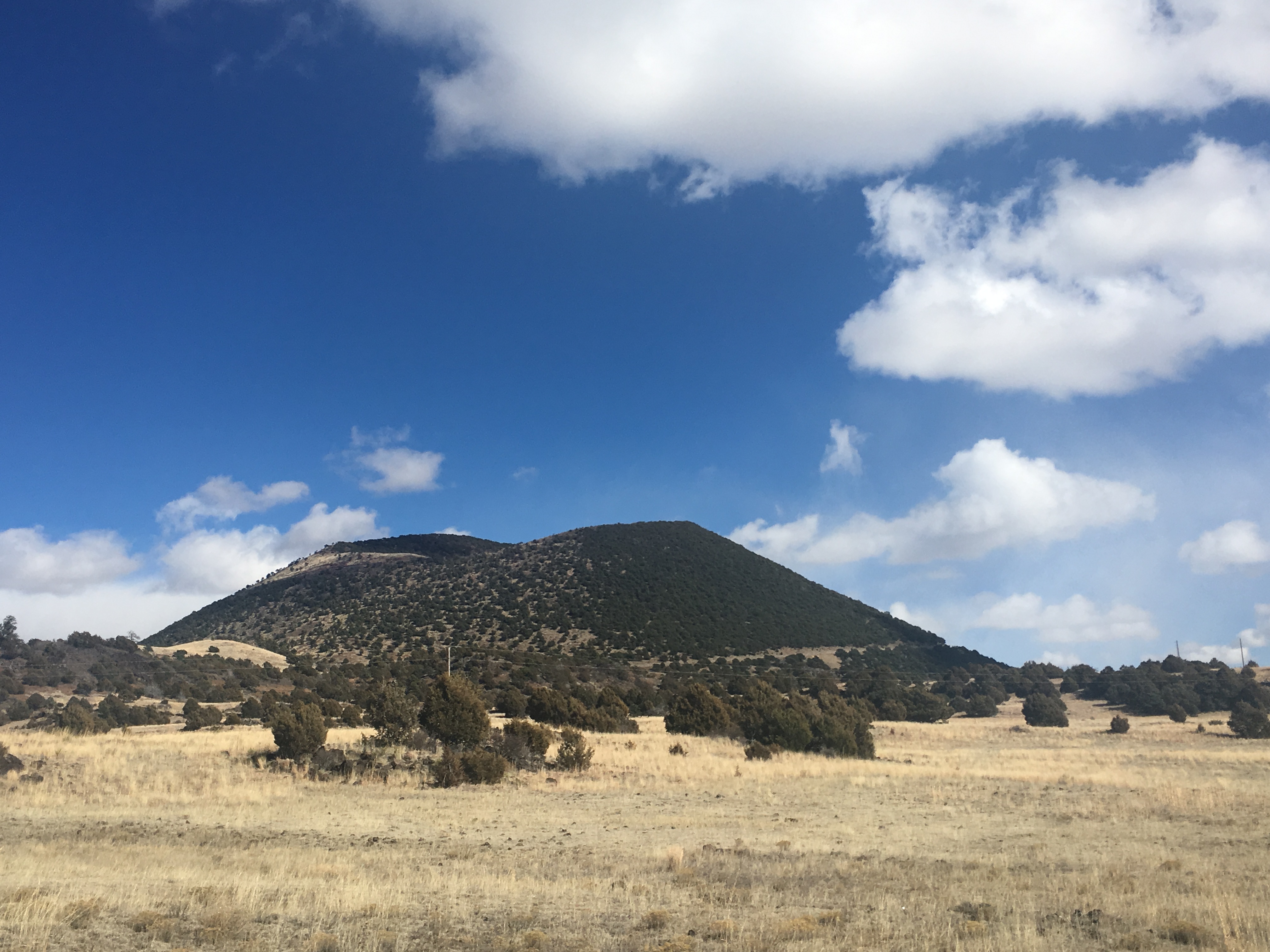
- Capulin Volcano National Monument – Right over the border in New Mexico, you drive to the top of the volcano. It is SUPER windy and there are two hikes at the top – one around the rim and one into the crater. There’s also a nice short round-trip walk near the visitor center. While this park costs $20, if you buy the $80 America the Beautiful National Park pass, you can get your monies worth in no time by visiting a handful of parks in a year. The ergo baby was perfect here, but our Addy hated the wind.
- Las Vegas – If you know geography, you’ll know we didn’t drive to the real Las Vegas. Las Vegas is a small town with a historic hotel, some graffiti and a town square with some statues. A good pit stop to stretch your legs on the way to something cooler.
- End Day – Roswell

Day 2 (approximate miles driven: 484 miles)

Draperies 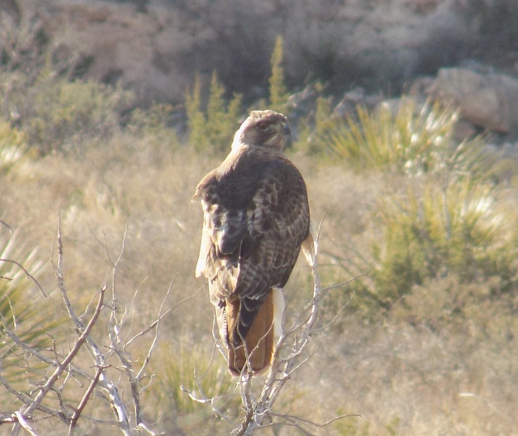
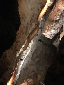
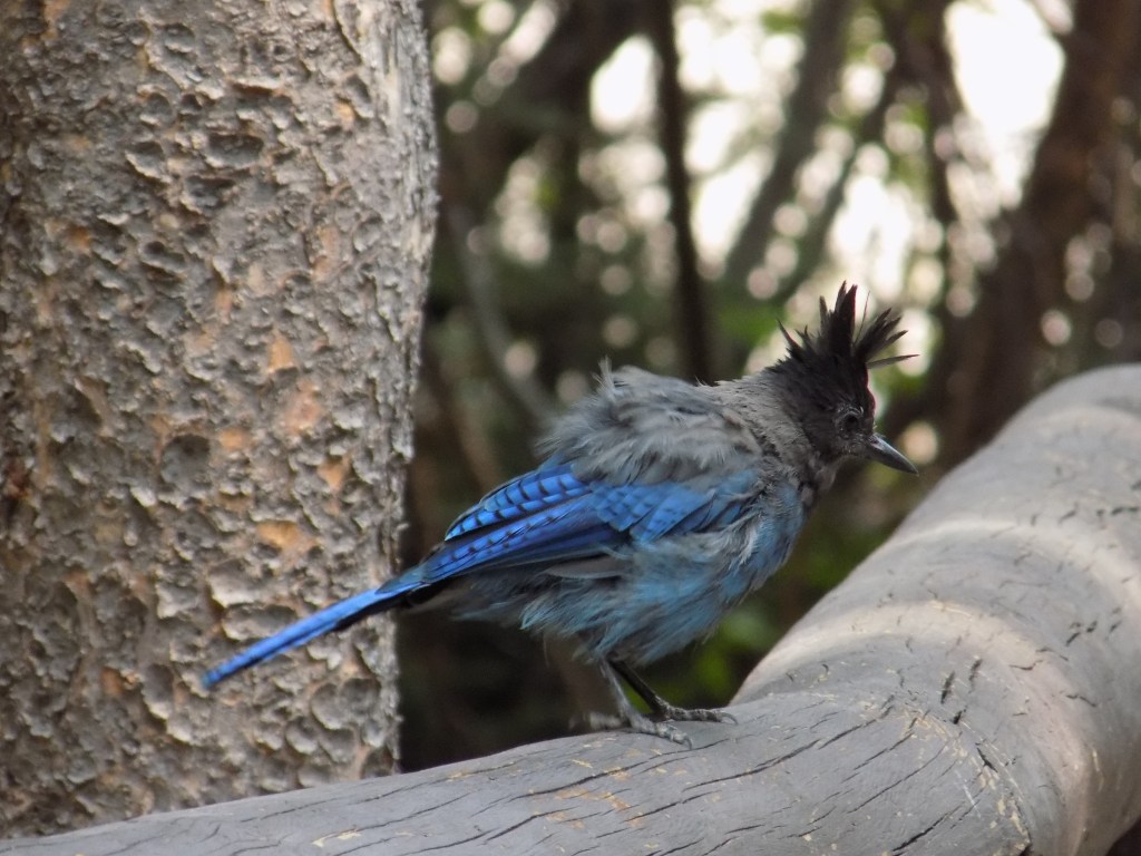
Hawk at the Caverns
- Bitter Lake National Wildlife Refuge – We woke up in Roswell (yep, the alien city with the alleged UFO citing). First thing in the morning, we drove the 8-mile wildlife loop. It was a very serene drive and a nice place to start the day.
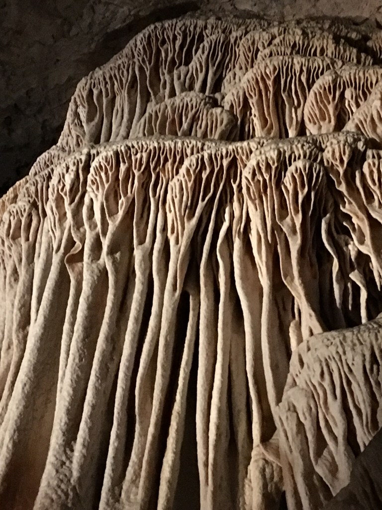
- Carlsbad Caverns National Park – This was one of the highlights of the trip and also covered by the America the Beautiful Pass (instead of $15 per person, the pass covers up to 4 people). The drive up the mountain to get the visitor’s center is beautiful as well as the one-way loop on Walnut Canyon Desert Drive. The walk down to the Big Room in the cave as well as the loop around it is filled with decorations or stalactites and stalagmites. There’s also an elevator option, which we took at the end back to the visitor’s center instead of attempting a steep walk up with Addy. Our ergo baby came in handy and Addy slept almost the entire time we explored. If you’re interested in taking a guided tour, make sure to buy your tickets in advance as they only take small groups and they sell out quickly. Based on our positive experiences of taking guided tours at Wind Cave National Park (SD), Jewel Cave National Monument (SD), Cave of the Winds (CO), and Luray Caverns (VA), this is something we wish we could have done here. We also enjoyed the short nature trail that looped back to the amphitheater (where you enter the cave).
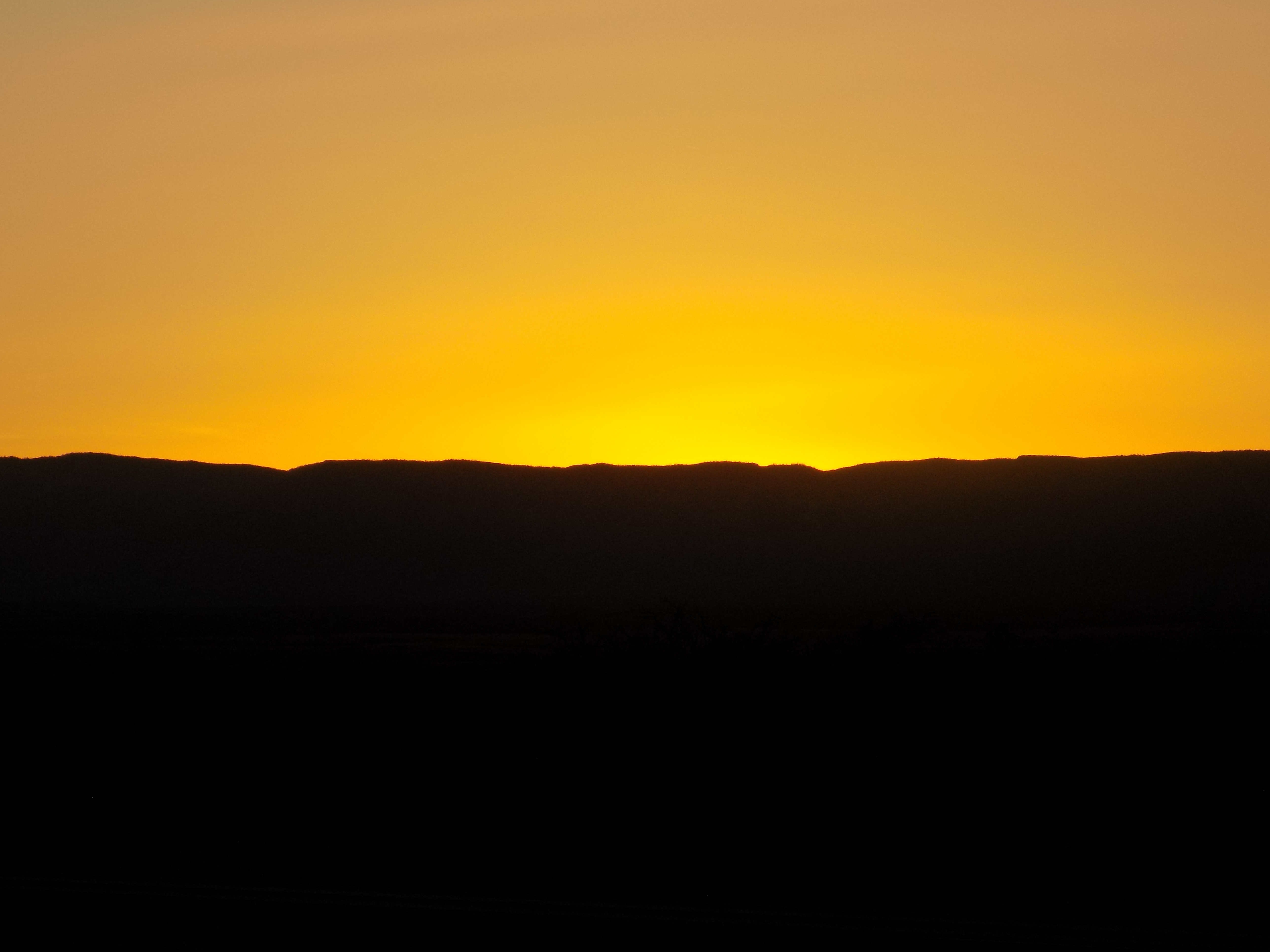
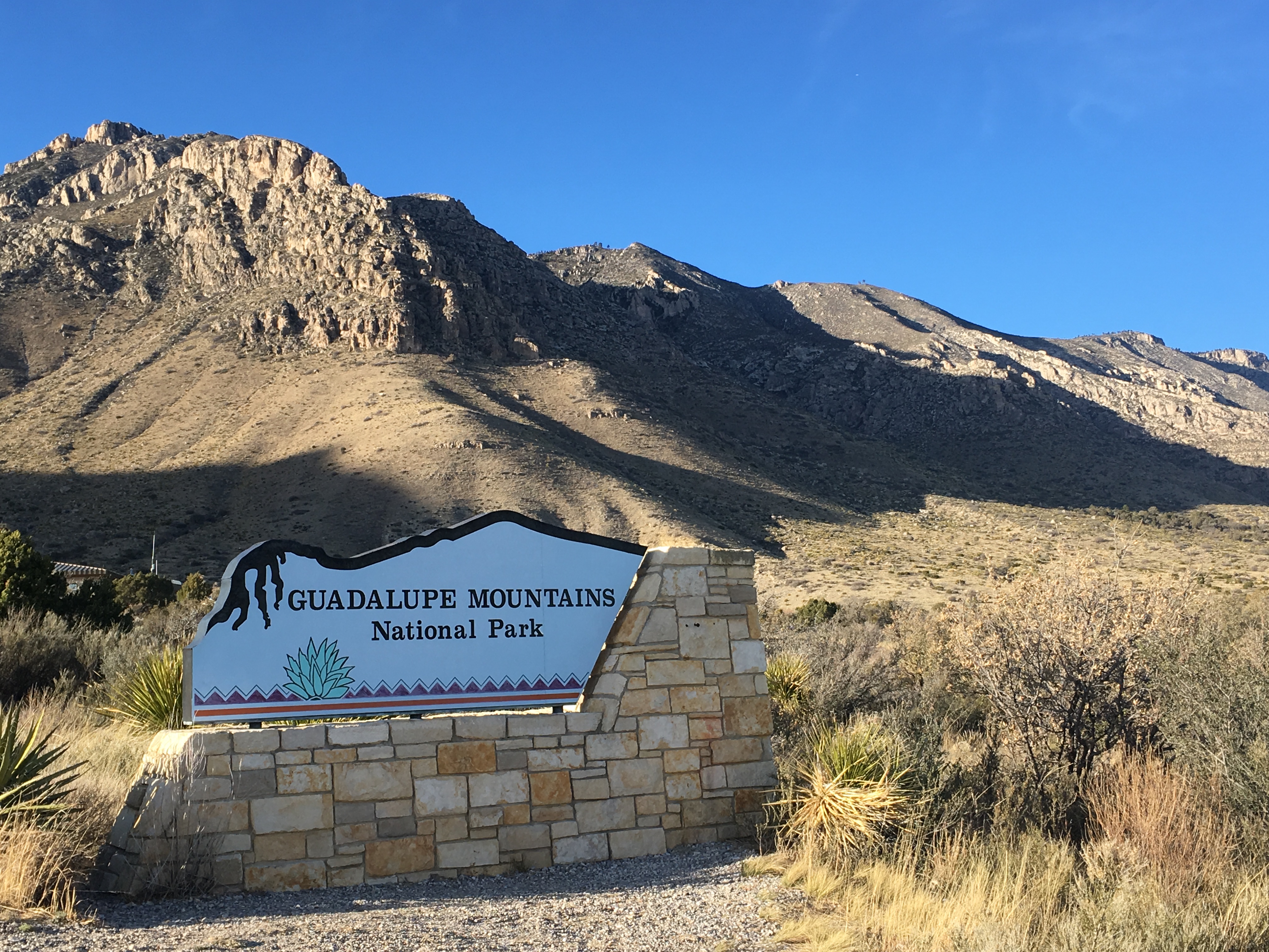
- Guadalupe Mountains National Park – This park is extremely close (like a 30 minute drive) from Carlsbad Caverns and right over the border into the northwest corner of Texas. We also went through a time zone change driving here. The scenery is beautiful and shouldn’t be missed. We weren’t here long, but we enjoyed a gorgeous sunset over this park on the way back to New Mexico.
- End Day – Santa Fe

Day 3 (approximate miles driven: 147 miles)


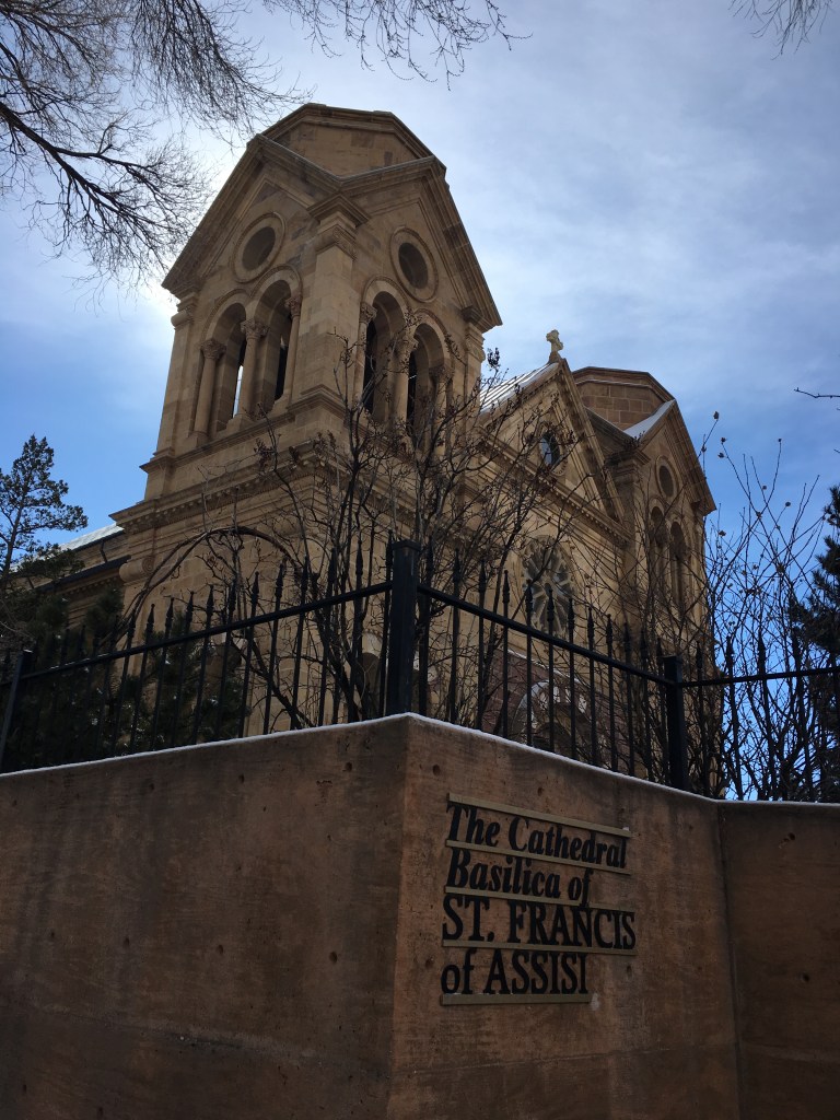
- Santa Fe – Waking up here was the best decision because this meant my SIL and I got to try the Christmas chili (red and green chili) breakfast burrito at The New Baking Company. It was DELISH! From here it was a short drive to old town Santa Fe. We parked a few blocks from the State Capitol at a meter (there’s a free week day parking garage, but it fills up quickly). Everywhere you walk there’s red chili hanging. It’s super pretty and unique. The whole city has a unique vibe. We checked out the Cathedral Basilica of St. Francis, sipped a matcha latte and chai plus indulged and tried gelato samples from Café Atalaya and toured the utilitarian State Capitol building (found the accessible entrance through the connected Annex). The artwork throughout the Capitol was made by artists who lived in New Mexico at the time of creation and the views of the Sangre de Cristo Mountains are incredible. This was a stroller friendly couple of hours.
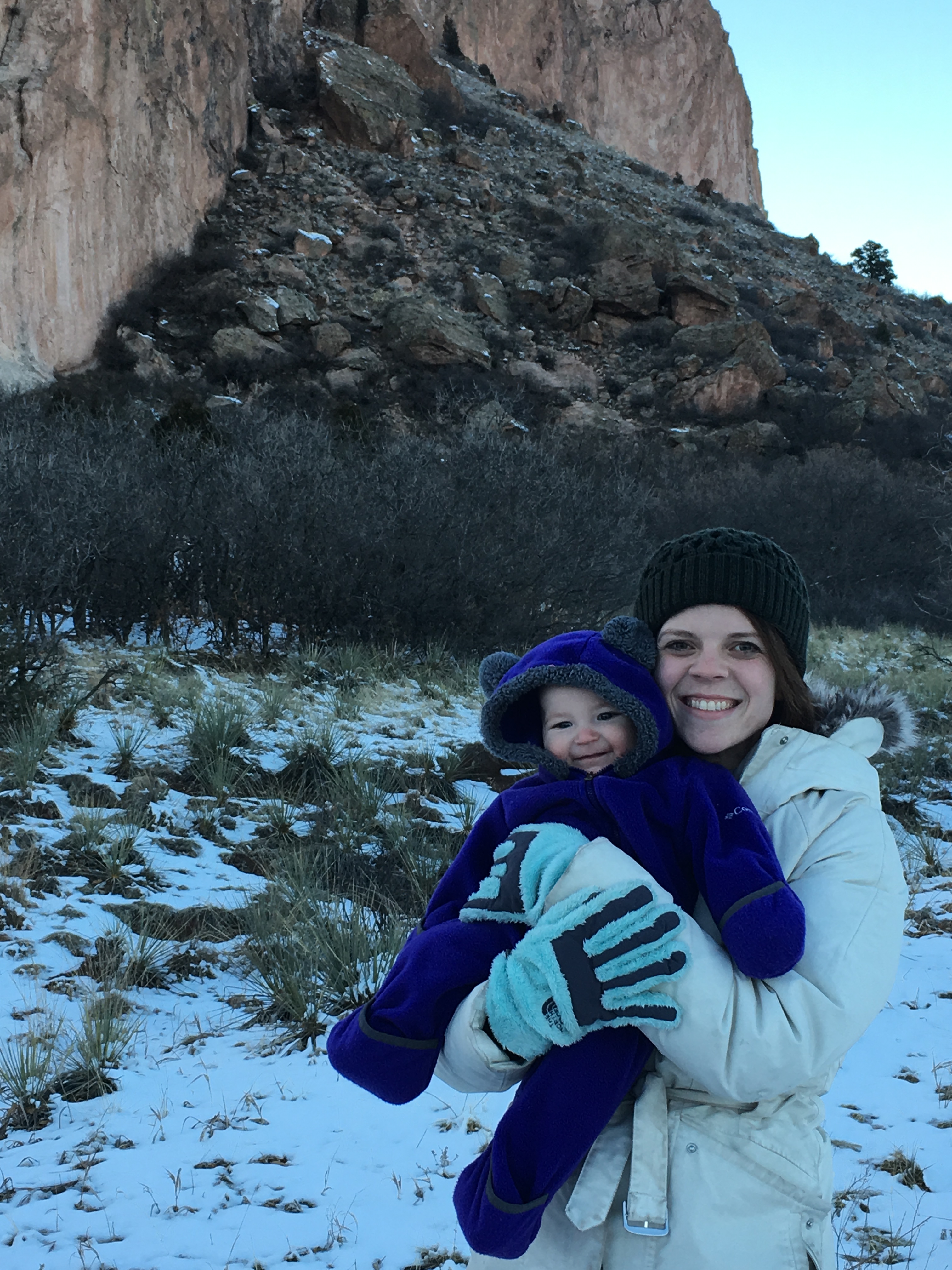
- Bandelier National Monument – This was another highlight of the trip! Starting at the visitor center, there’s a great hike up to the first set of houses. There are ladders to climb up and take a peek in the different houses. We continued past these to the Alcove House! This is a 140 foot ascent up multiple ladders (at your own risk) and we did this with our baby in tow! My husband was brave enough to wear her up and down and VERY lucky for us, she slept through it all. The experience is exhilarating and the view from the top is worth the climb. We also saw mule deer and an Abert’s squirrel (they have funny ears).
- Albuquerque – We saw the most gorgeous sunset on our drive to ABQ. I would highly recommend finding a good spot to post up for pics! We found an evening coffee spot called Prismatic Coffee, drove around for a bit and then called it a night.
- End Day – Albuquerque

Bandelier National Monument 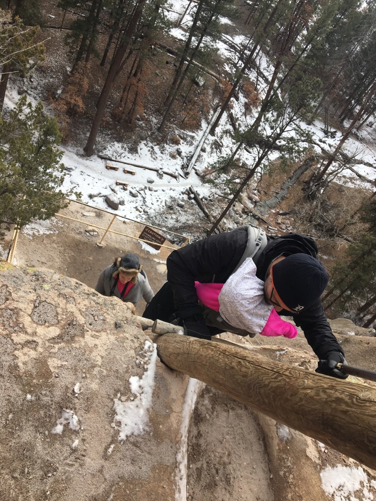
Ascent up to Alcove House
Petroglyphs 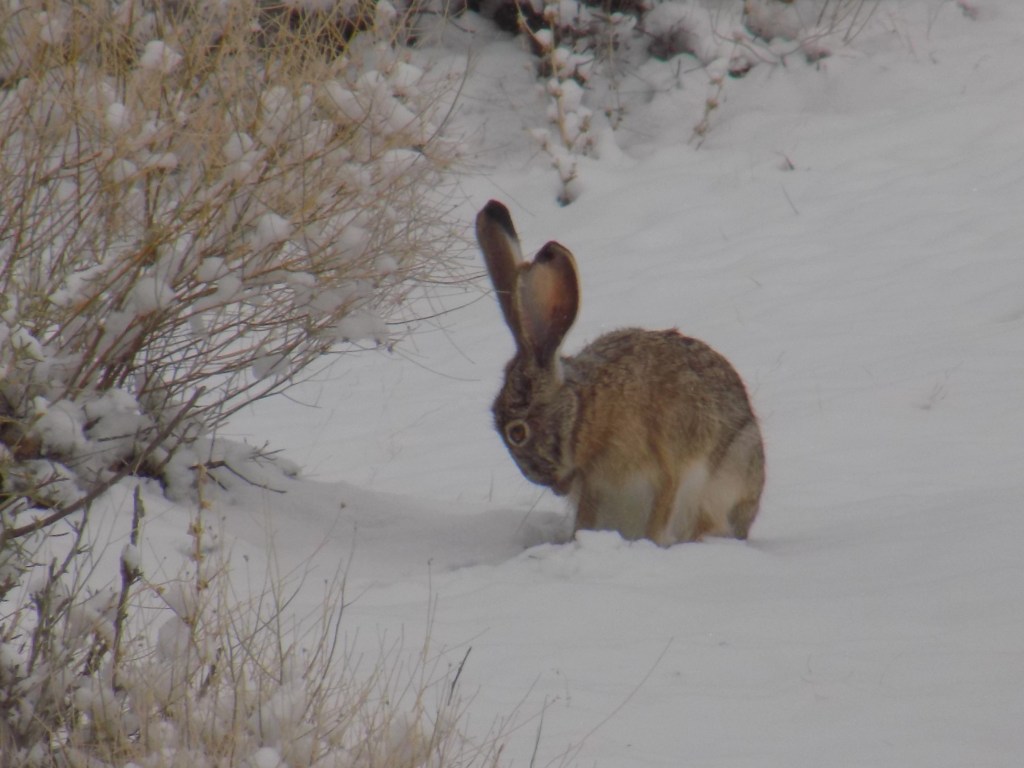
Day 4 (approximate miles driven: 330 miles)
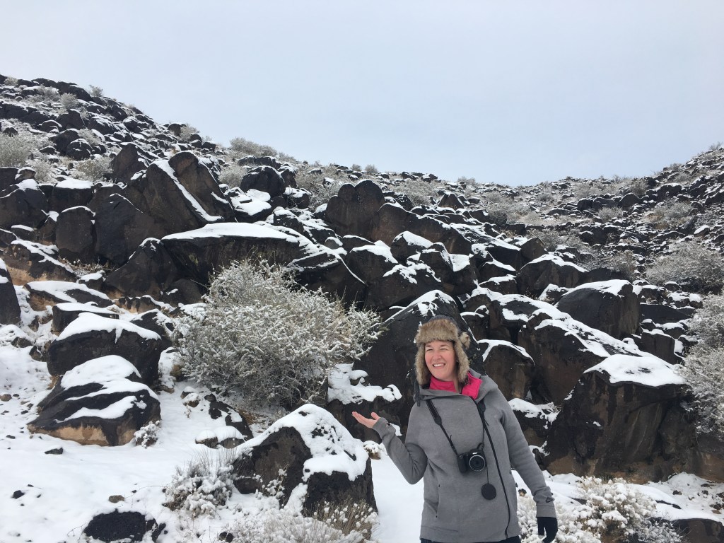
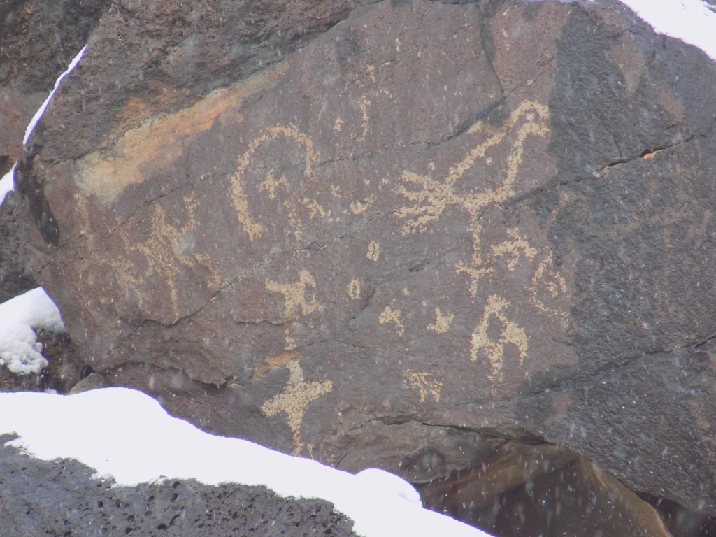
- Petroglyphs National Monument – We happened to be in ABQ when there was TONS of snow, so there wasn’t a sunrise like we had hoped to see in the Volcanoes Day section of this park. We ended up being able to hike at Piedras Marcadas Canyon. This was a really fun hike to do in the snow (with the place to ourselves) and we were still able to see petroglyphs and lots of black-tailed jackrabbits.
- Tent Rocks National Monument – We were super bummed we drove all the way here and it was unexpectedly closed. If you’re in this general area between Santa Fe and ABQ, definitely try to add it to your list! The cone shaped rock formations are reminiscent of the hoodies we saw at Bryce Canyon National Park.
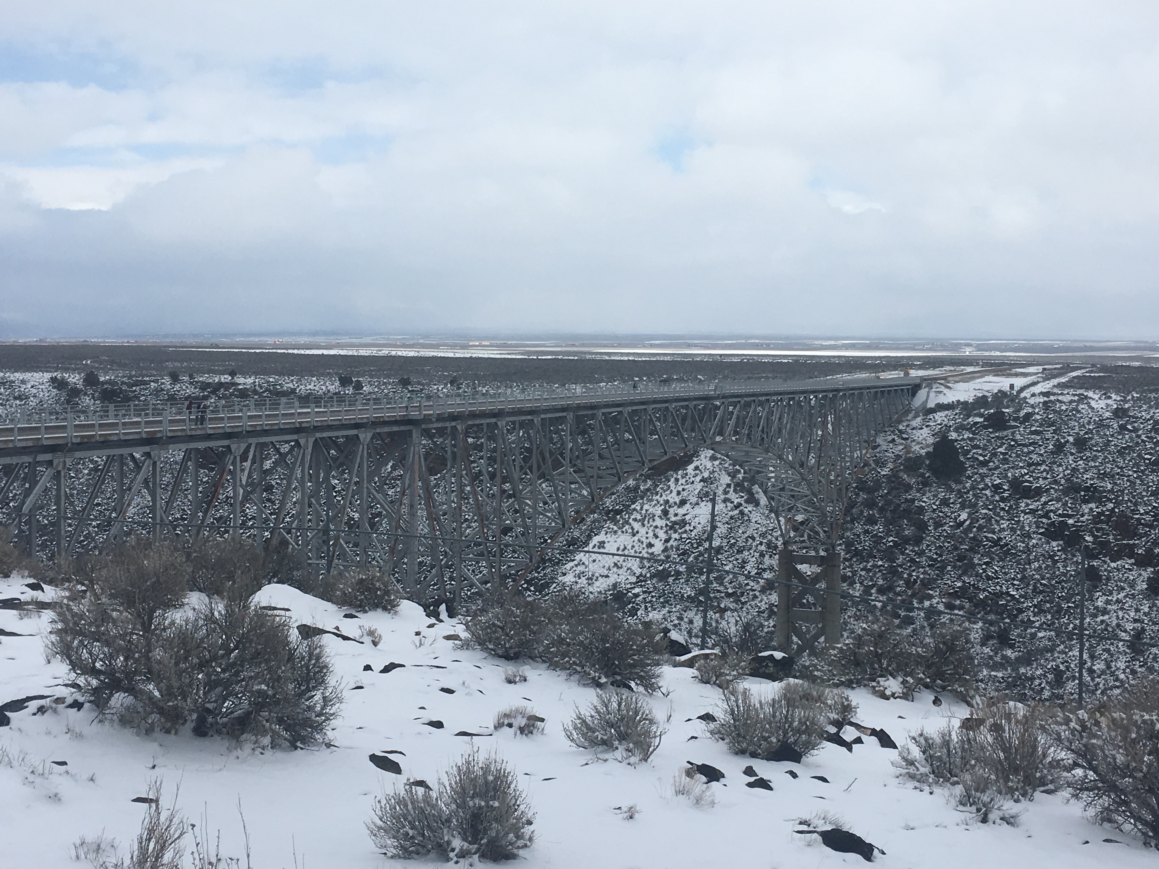
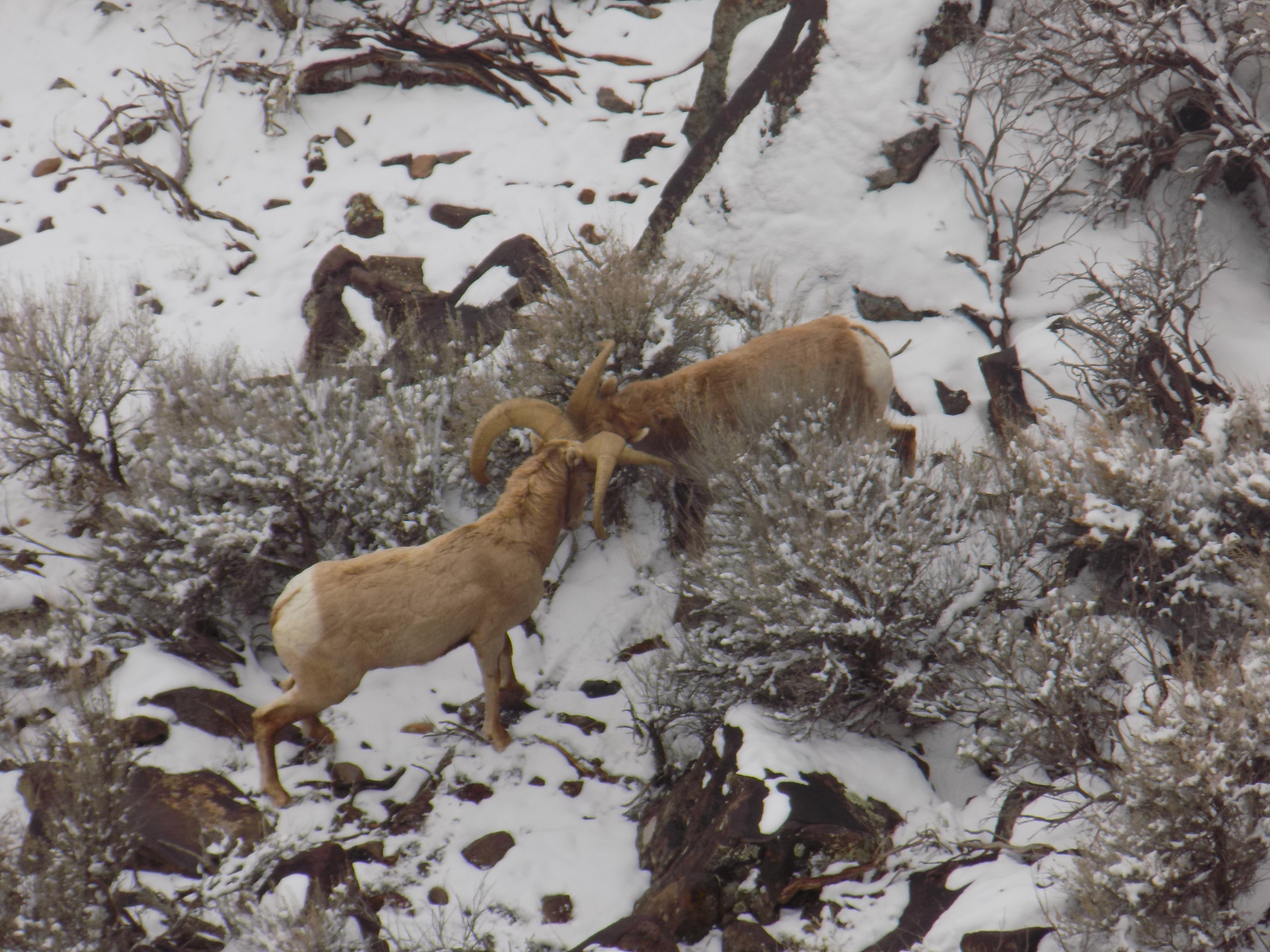
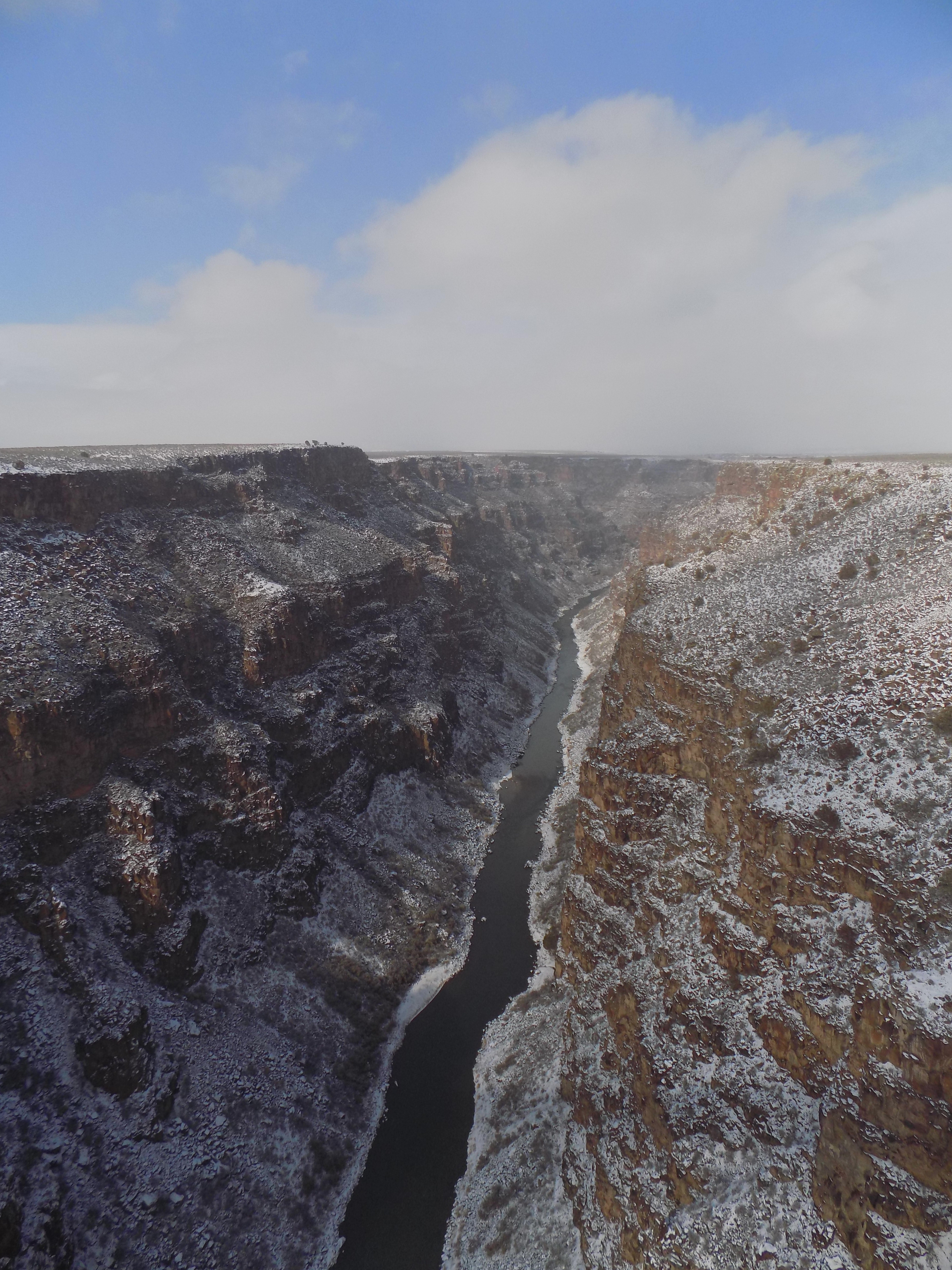
- Rio Grande del Norte National Monument – This was a way better stop than we anticipated. The bridge itself and views are amazing. We got super lucky too and saw 5 big horned sheep grazing below, two of which were males with huge horns. There’s ample parking on both sides of the bridge and facilities.
- Taos – We didn’t quite make it to the “mountain village”, but we did enjoy a coffee shop here before the rest of our drive to Great Sand Dunes National Park & Preserve.
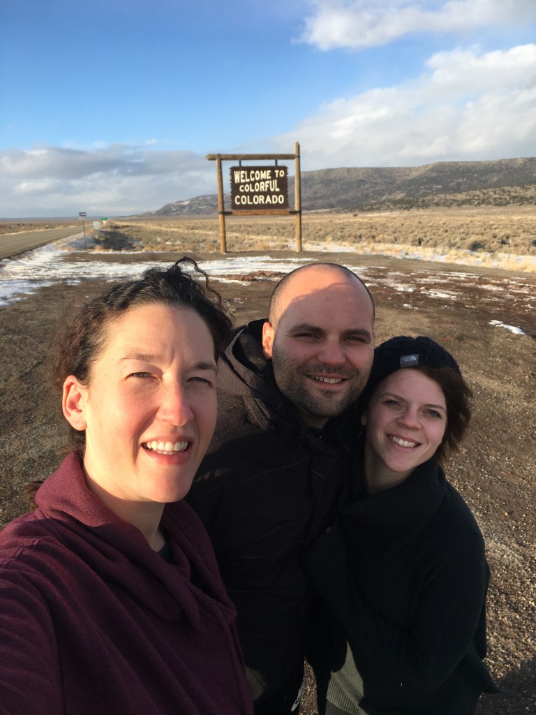
- Colorful Colorado – Don’t miss the opportunity to jump out of the car and get a picture with the “Colorful Colorado” sign at the border!
- End Day – Alamosa (near Great Sand Dunes)
Day 5 (approximate miles driven: 330 miles)
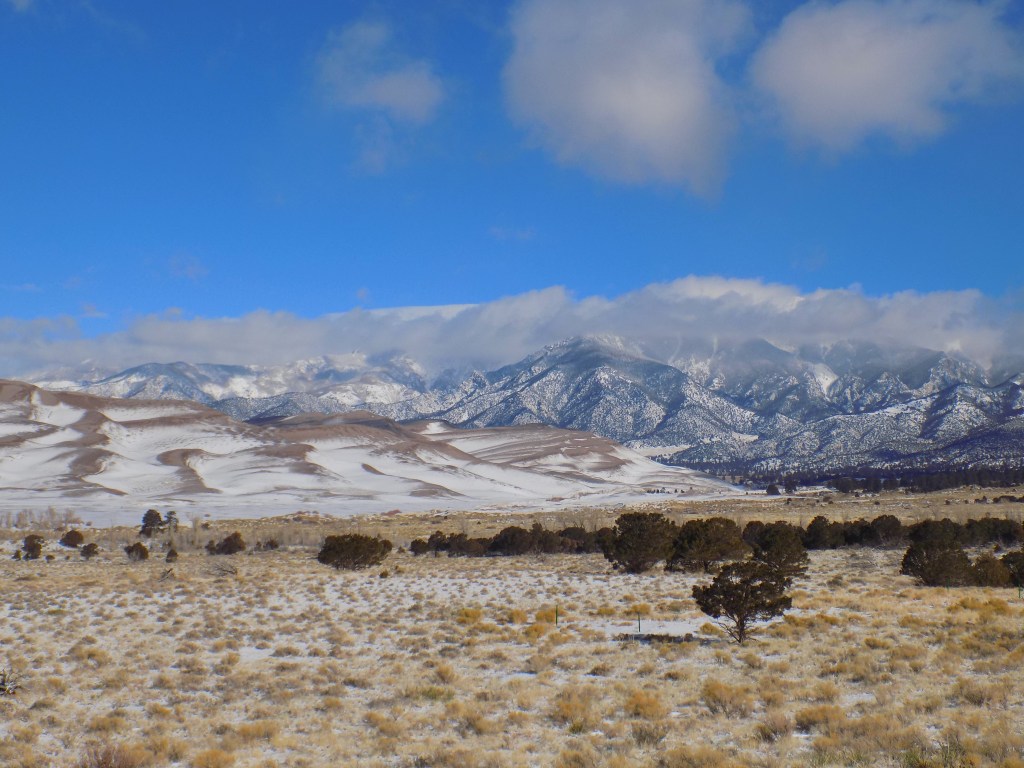
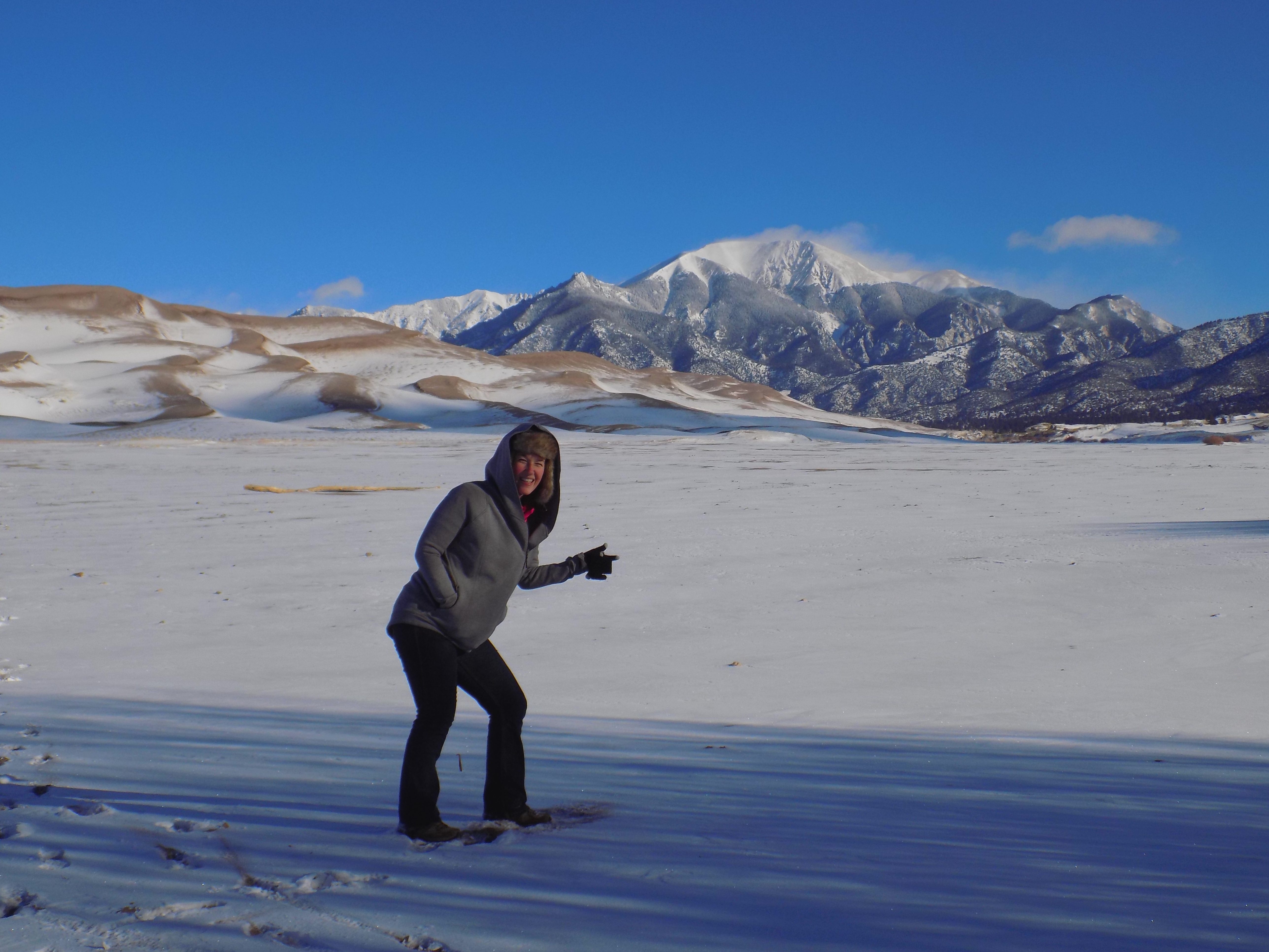
- Great Sand Dunes National Park & Preserve – We drove the park road the night before and saw tons of elk grazing. On our sunrise drive into the park, we got to take in some amazing views and you realize the sand dunes are right before your eyes in front of humungous mountains. We went right past the visitor center and we were able to hike onto the snow covered sand dunes. Again, we had this place to ourselves! It was cool to see different animal prints in the snow covered sand. It’s unlike any place we had ever been before and also one of the highlights of the trip. We didn’t have the right kind of vehicle for the terrain and snow covered incline, but if you do, it looks like nearby Zapata Falls would be an amazing place to see.
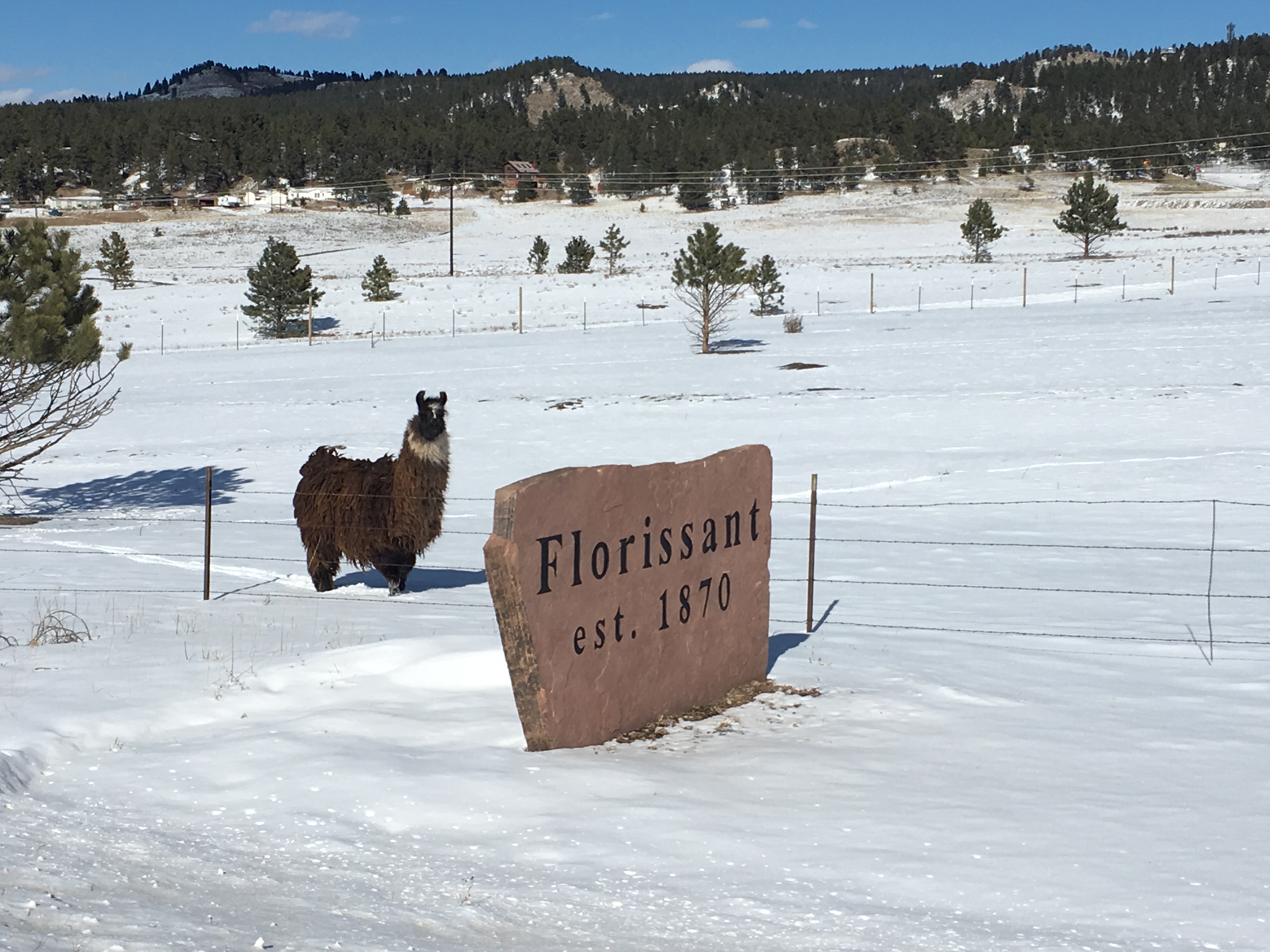
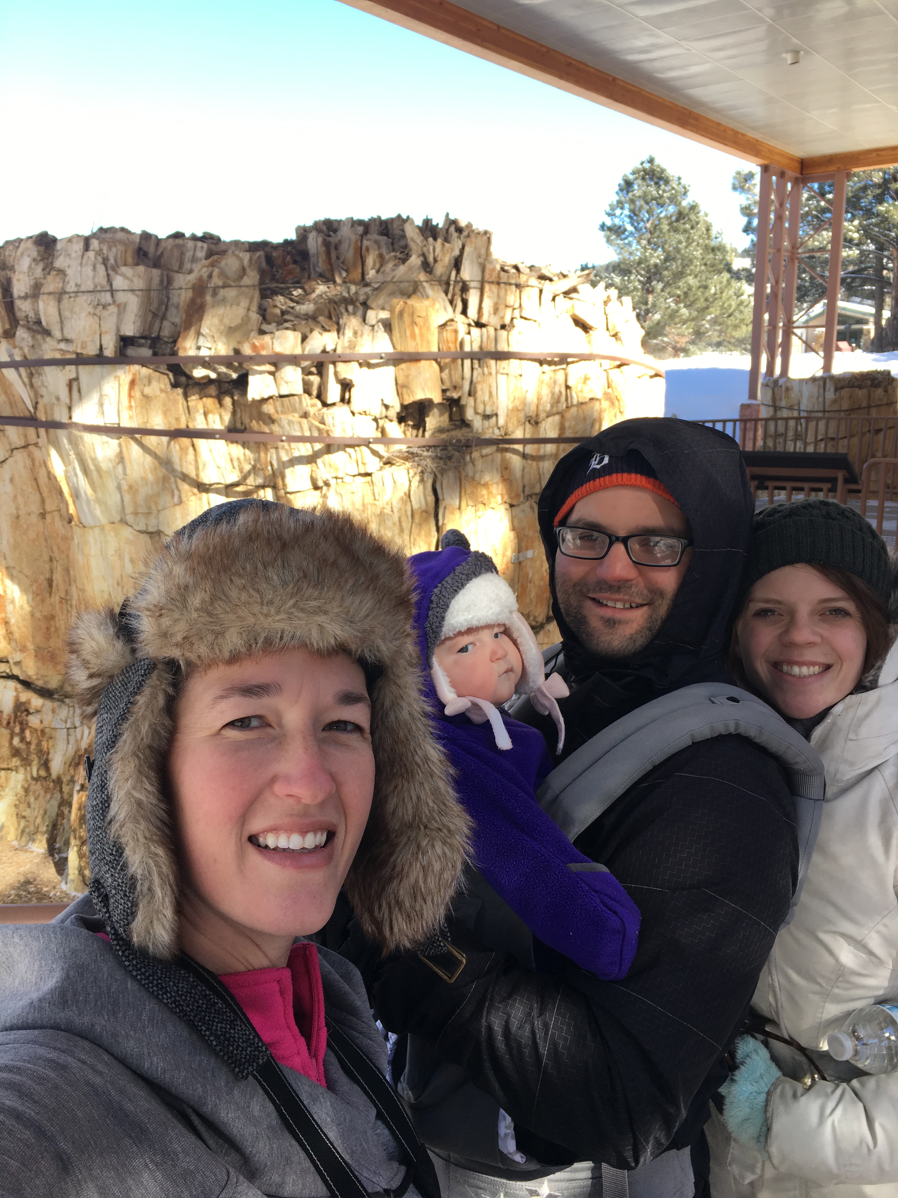
- Florissant Fossil Beds National Monument – This wasn’t in the original plan, but when we realized we had a little extra time on our hands, we headed here. There are fossilized redwood stumps and we enjoyed a snow-covered trail here. There were also tons of fossils to see in the visitor center. We didn’t see signs for it, but there’s a new National Monument called Browns Canyon in the general area between Great Sand Dunes and here that looks like it would be fun to see. You can see the Arkansas River when you’re driving.
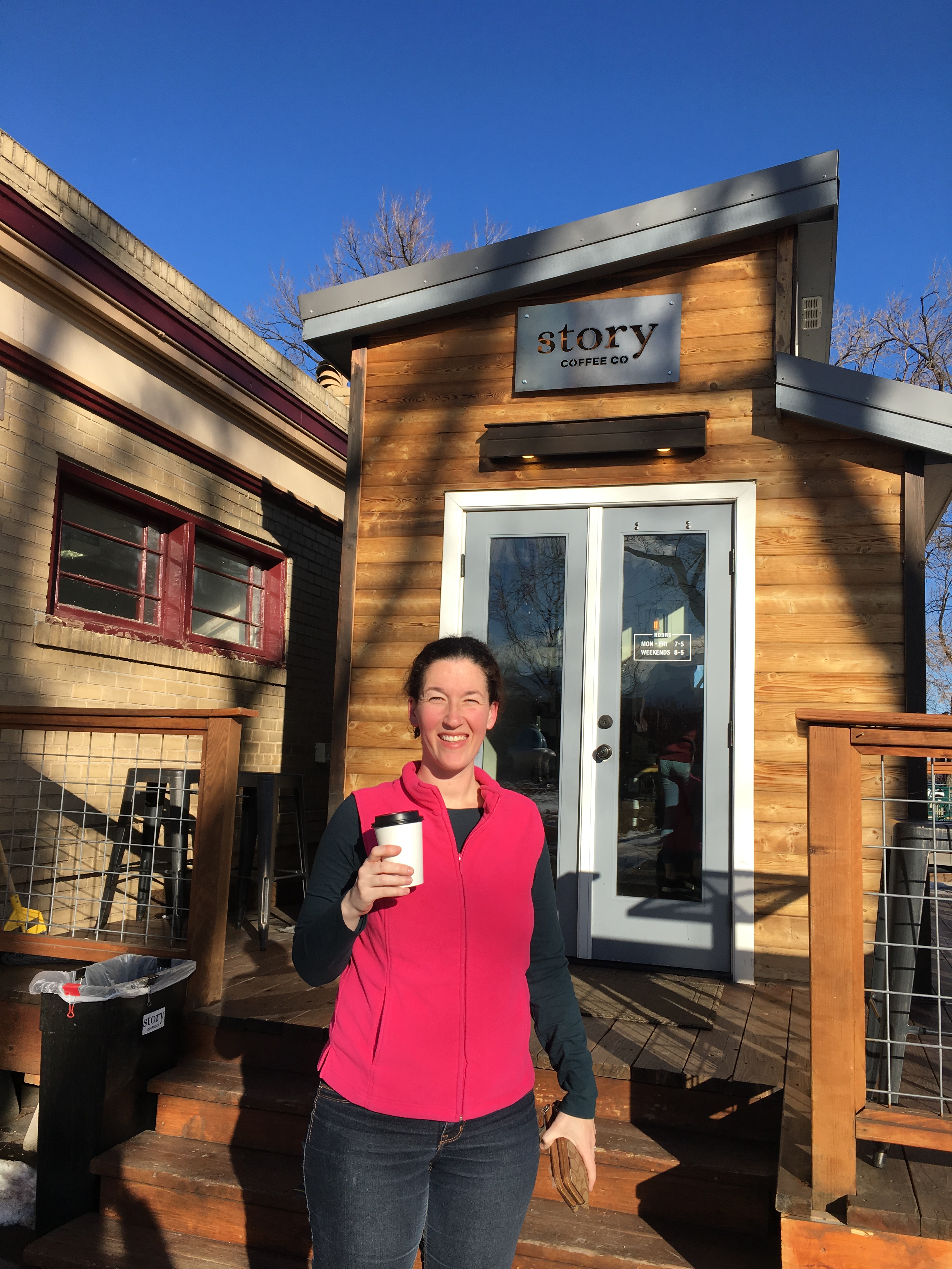
- Colorado Springs – At 4.9 stars when we checked, Story Coffee Company is a super cute, tiny coffee shop located right in the center of town. Our drinks were delicious and kept us warm as we looped around town checking out the street art and beautiful mountain views. With about an hour left before we needed to head to Denver, the Garden of the Gods (free) was a perfect way to spend the sunset. The red rocks make for the ideal photo backdrop. If you have more time, Cave of the Winds is located here.
- End Day/Trip – Returned rental car to the Denver airport and took a red eye flight home; Car rentals can be really expensive out of Denver Airport, so make sure to shop around. We got the best deal using Car Rental 8, but in the past I’ve often found the best deal using CarRentals.com .
Would we do it again? Absolutely. Would we recommend waiting until it were slightly warmer out? Perhaps. However, the BEST benefit of traveling during the off season is you get places like National Parks and Monuments all to yourself. At many of the places we visited, we either had the place to ourselves or we saw less than a handful of people. The other BIG benefit is you can find CHEAP hotels in the off season, if you have a baby like us and can no longer carsleep your way around the country. Keep up with us on Instagram @TeamTravelsBaby as we head out on our next adventure!


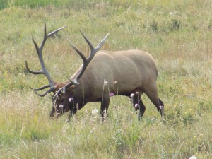 We had a blast stopping in the pull offs and on the side of the road to capture photos and video of the adult and young elk. We got some great ones of elk crossing the street and grazing on the side of the road.


 If you arrive before the park opens, there’s no one at the gate, however, if you plan on seeing multiple National Parks, it’s worth spending the $80 to get the
 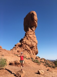 One benefit of starting early is you’re likely to beat the tour busses that are bound to come and stop at these points of interest. Balanced Rock is perfect for taking a short stroll and stretching your legs from the car ride.


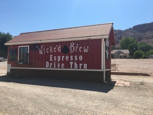 This little trailer coffee shop offered delicious iced lattes with unique flavor combinations.